

SLAM 3D Mapping
Simultaneous Localization And Mapping
In an era where technology continuously stretches the boundaries of possibility, 3D mapping is a testament to human ingenuity. This innovation has carved new avenues of understanding and operation within the construction sector and mining, surveillance, and disaster management industries. Find out more about Exyn’s SLAM 3D mapping.

Autonomous 3D SLAM Mapping with ExynAI
3D mapping is used successfully in many industries, including construction, land surveying, real estate, agriculture, forestry, and disaster management. This robotic technology allows surveyors to analyze survey-grade maps of previously unreachable locations in real time while the drone is in flight.
Exyn’s SLAM pipeline enables the robot to autonomously navigate many extreme field conditions, including GPS- and comms-denied environments with little to no light, communications with a pilot, or existing infrastructure.
What is SLAM?
SLAM, or Simultaneous Localization and Mapping, is a sophisticated computational technique that enables robots, such as self-directed drones, to chart out unfamiliar environments while keeping track of their location. This ability is beneficial in areas where GPS signals are unreliable or unavailable. To discover more and embark on a journey of 3D autonomous mapping.
A Glimpse Into SLAM
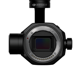
At the heart of SLAM are two pivotal sensors. The first, an IMU, tracks a robot’s motion and orientation. Think of it as your smartphone's gadgetry distinguishing between portrait and landscape modes. Complementing this is the robot’s visual sensor. In the Exyn models, the Velodyne LiDAR Puck LITE sensor serves this role, showering the environment with beams and capturing any figure as precise data points. These combined inputs create a dynamic point cloud—a real-time 3D map of the surroundings.
ONLINE SLAM: THE NEED FOR SPEED
Online SLAM takes the driver’s seat when robots are in action, detecting and dodging obstacles. Data processing must match its pace with a robot potentially covering ground at 2 meters/second. As the LiDAR assesses the terrain, algorithms like LIDAR Odometry and Mapping (LOAM) work behind the scenes to craft an evolving local map.
Interestingly, robots powered by ExynAI construct dual maps during navigation. One delineates edges, while the other focuses on surfaces. This on-the-fly mapping, combined with real-time adjustments, ensures robots sail smoothly through their environment.
OFFLINE SLAM: THE PURSUIT OF PRECISION
Once a robot’s journey concludes, the spotlight turns to Offline SLAM. Here, the emphasis is on something other than speed – accuracy. The raw sensory data, logged throughout the journey, undergoes rigorous refinement. Enter ExSLAM, Exyn’s post-processing maestro. It gleans the point cloud data, refining and readying it for third-party applications.
A key aspect of Offline SLAM is the loop closure. As a robot roams, uncertainties about its exact position can accumulate. Loop closure is akin to a eureka moment when the robot realizes it has returned to a previously visited spot, allowing it to adjust and refine its internal map.

Mapping Tomorrow: SLAM’s Evolution
The SLAM horizon is promising. As technological advancements like colorization pipelines loom, the potential to superimpose RGB data on point clouds could redefine 3D modeling. Moreover, integrating GPS data in post-processing endeavors promises even more accurate and grounded mapping results.
As online and offline SLAM realms converge and evolve, how robots understand and navigate their world will continue to revolutionize. To read more about the nuances of online and offline SLAM systems, click here.
Terra Excel is on Instagram!
From stunning aerial shots on #terraexceldjifamfeatures to robust drone applications in precision agriculture, join us on Instagram for a taste of drone life from Enterprise and enthusiasts.