

DJI Mavic 3M
See More, Work Smarter
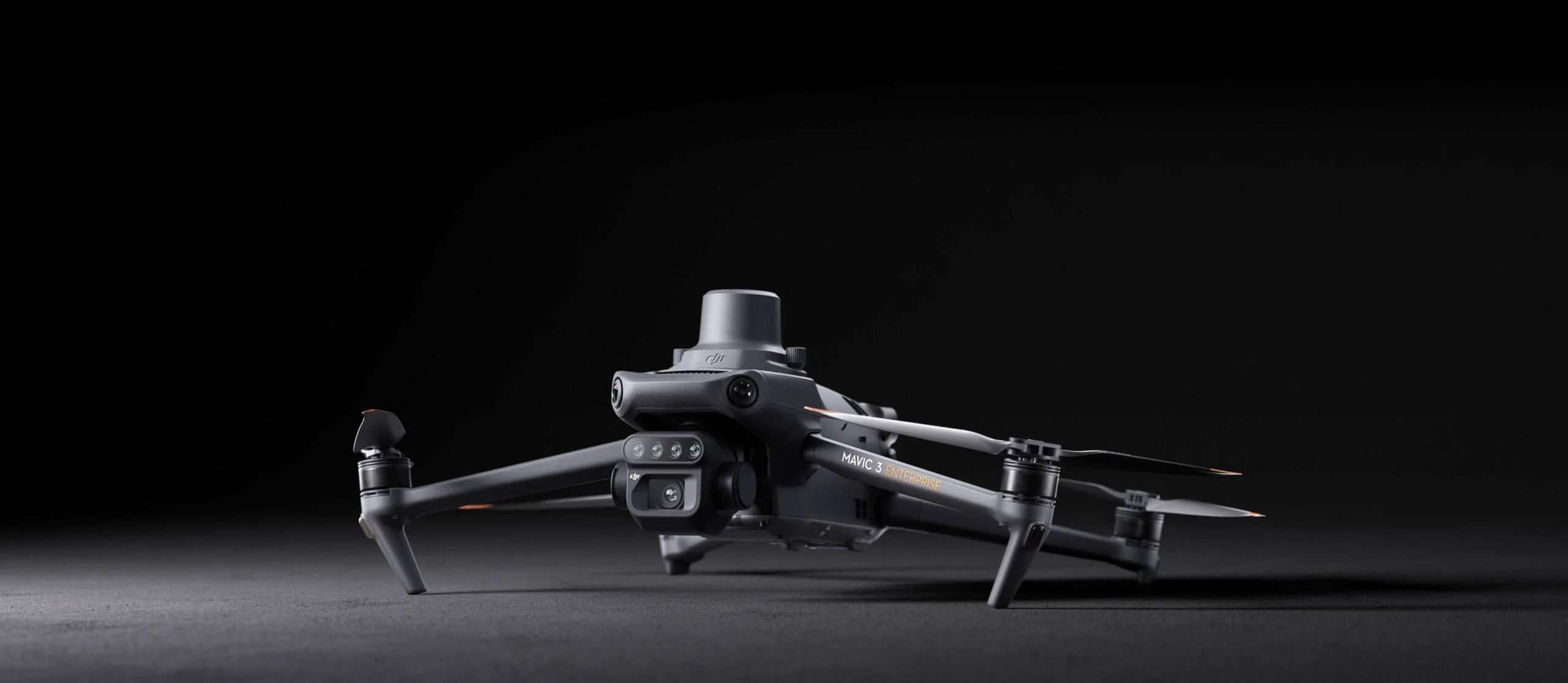
Compact and portable
Foldable for easy storage
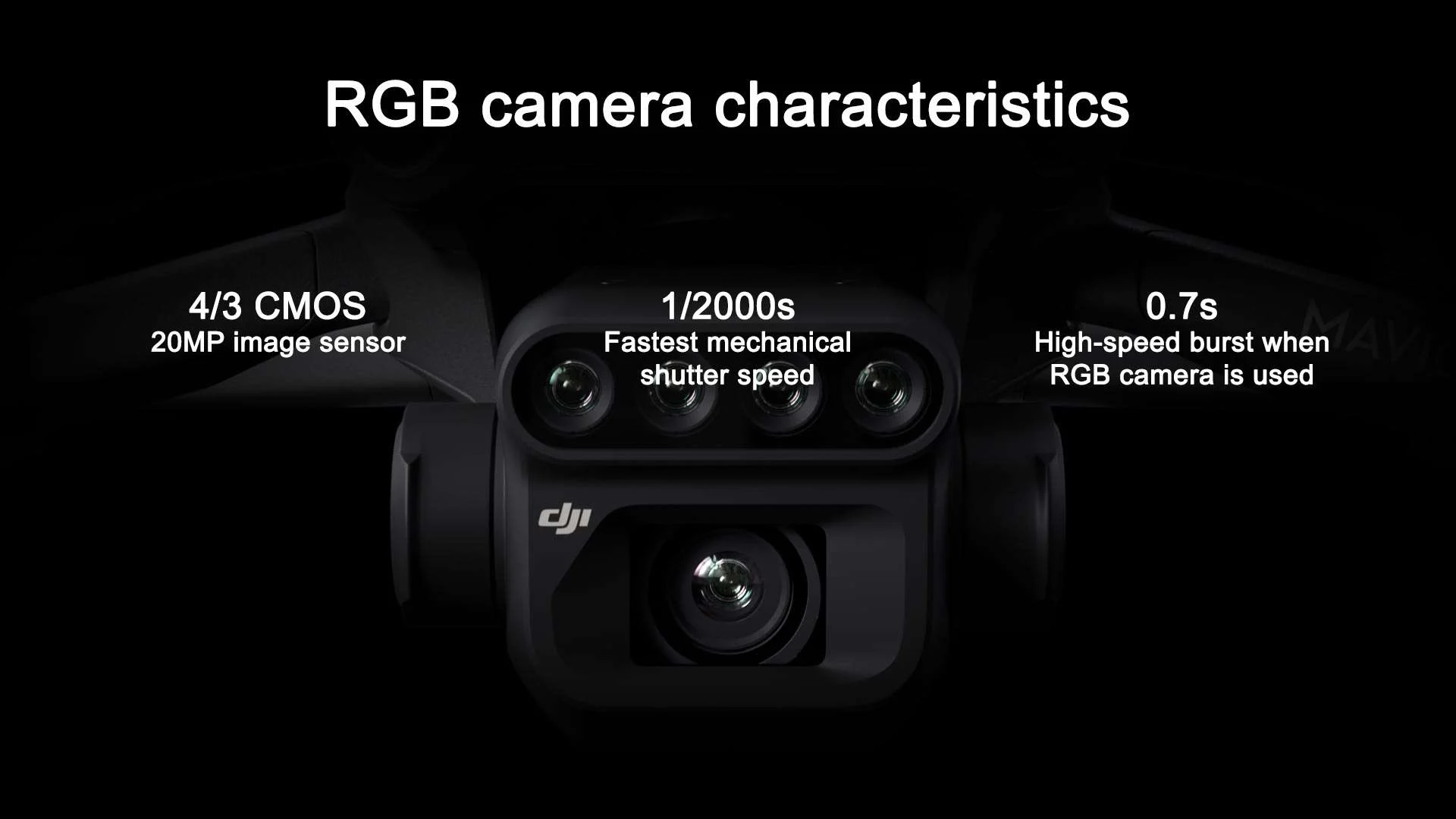
RGB Camera
20 MP
4/3 CMOS, mechanical shutter
Precise positioning
Centimeter-level RTK positioning
Microsecond-level time synchronization
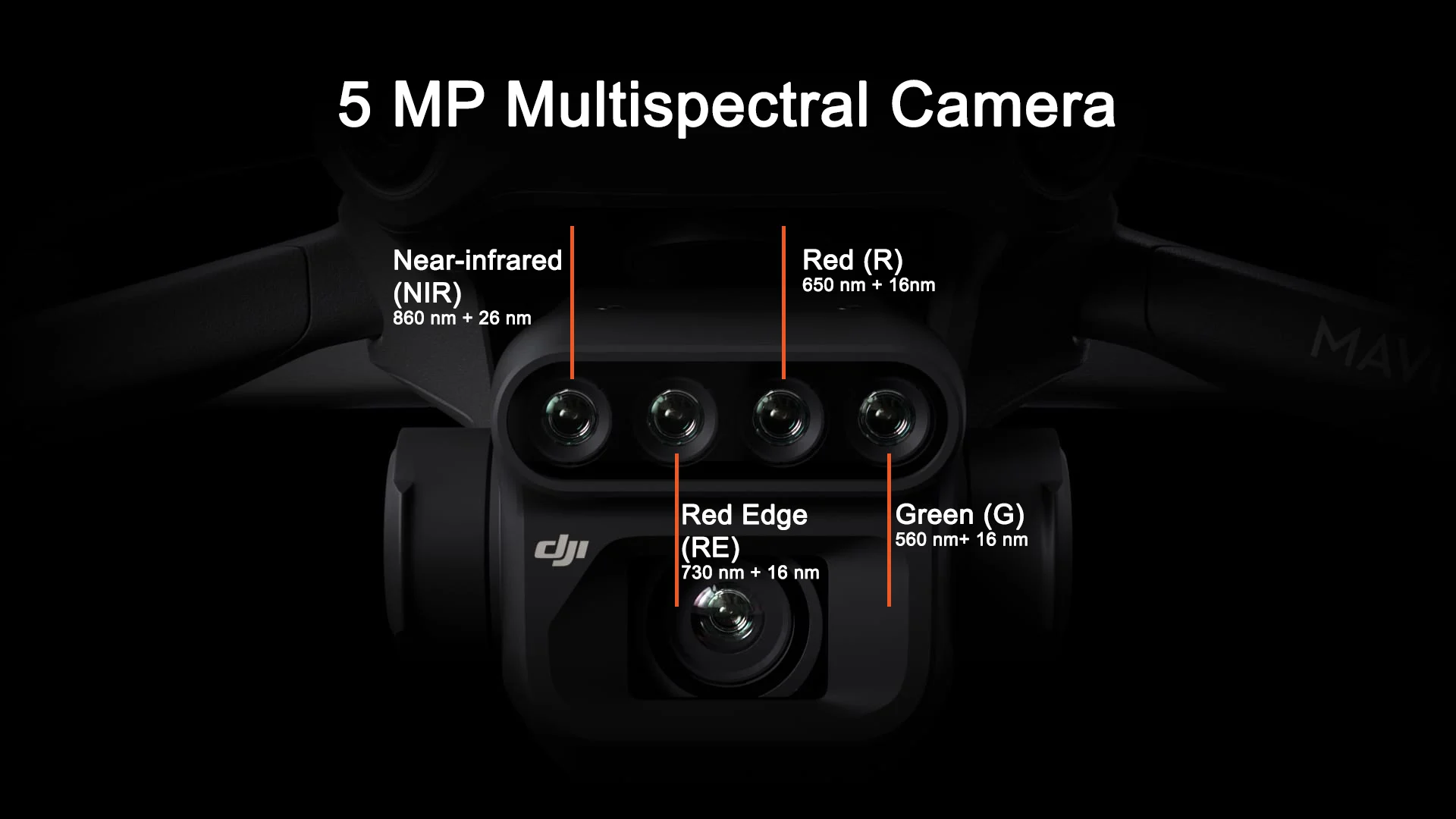
Multispectral Camera
4 x MP
G/R/RE/NIR
Safe and Stable
Omnidirectional Obstacle Avoidance
15km Transmission Distance
Efficient aerial surveying
Up to 200 hectares per flight
Multispectral + RGB imaging system
Highly integrated imaging system
Newly upgraded imaging system with one 20MP RGB camera and four 5MP multispectral cameras (green, red, ref edge and near infrared.
Enables applications such as high-precision aerial surveying, crop growth monitoring, and natural resource surveys.
Sunlight Sensor
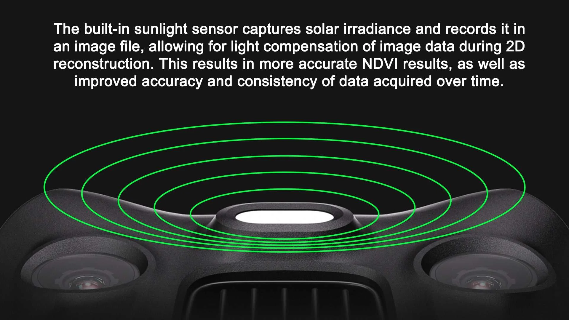
RTK Module
Accurate images that capture every pixel
Mavic 3M with RTK module for centimeter-level positioning. Flight control, the camera, and the RTK module sync in microseconds to accurately capture the location of each camera’s imaging center. This enables Mavic 3M to do high-precision aerial surveying without using ground control points.
Efficient and Reliable Battery Life
Ultra-long battery life, fast bursts
43 minutes
Cruise time
200 hectare
A single flight can complete mapping operations over an area of 200 hectares.
Fast Charging
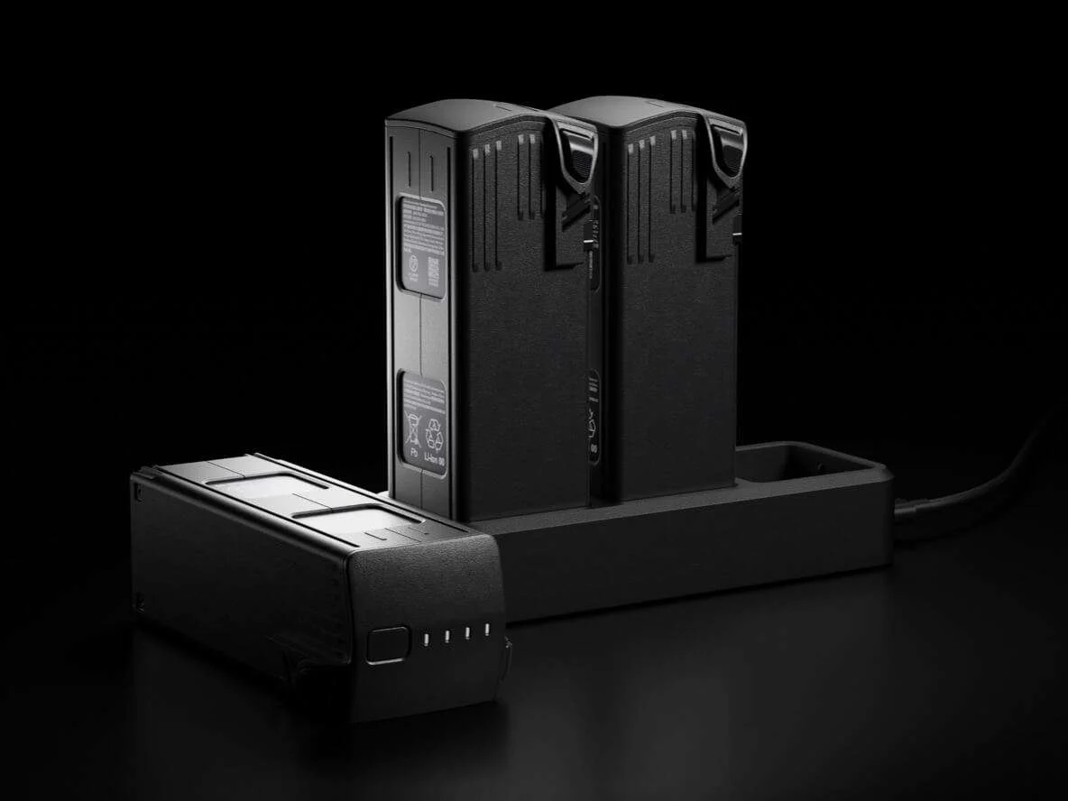
100W Battery Charging HubHigh-efficiency fast charging88W fast chargingAircraft
Stable signal, smooth image transmission
The O3 transmission integrates two transmitting signals and four receiving signals to support 15km ultra-long transmission distances.
Omnidirectional obstacle sensing, terrain-follow aerial surveying
The aircraft features multiple wide-FOV vision sensors that accurately detect obstacles in all directions for omnidirectional obstacle avoidance. The terrain-follow aerial surveying can be easily performed in steep-slope landscapes.
Applications
Mavic 3M allows terrain-follow aerial surveying of orchards, even on sloped landscapes. Together with DJI Terra or DJI SmartFarm Platform to reconstruct high-resolution orchard maps, automatically identify the number of trees, distinguish trees from other obstacles or objects, and generate three-dimensional operation routes for agricultural drones, making operations safer and more efficient.
Guide variable rate applications
For rice fertilization, cotton growth regulation, and potato foliar fertilizer spraying, the Mavic 3M is used to obtain multi-spectral images of crops. DJI Terra or the DJI SmartFarm Platform can then generate NDVI and other vegetation indices maps, capturing differences in crop potential and generating prescription maps that allow agricultural drones to execute variable-rate application. This ultimately allows users to reduce costs, increase yield, and protect the environment.
Mavic 3M aerial surveying
DJI Terra / DJI SmartFarm Platform Mapping
Generate 3D Routes
Agricultural Drone Operation
Open Echosystem
Cloud API
The Mavic 3M can be directly connected to a third-party cloud platform via Pilot 2’s built-in DJI Cloud API based on the MQTT protocol. There is no need to develop an app separately to enable the transmission of UAV equipment information, live streaming, photo data, and other information.
MSDK
The Mavic 3M supports Mobile SDK 5 (MSDK5) with a fully open-source production code sample. The MSDK5 makes it possible to develop a proprietary control app for UAV field patrol, smart surveying, and other scenarios, making it more user-friendly.
Environmental Monitoring and Natural Resources Survey
The Mavic 3M can also be used in environment and natural resource surveys, such as water enrichment monitoring, forest distribution surveys, urban green area surveys, and more.
Intelligent field scouting
The Mavic 3M can carry out automatic field scouting. The field scout images can be uploaded to the DJI SmartFarm Platform in real time through a 4G network. It can find abnormalities, such as emergence deficiencies, weed pressure, and crop lodging in a timely manner. It can also conduct intelligent analyses, such as cotton seedling identification and rice production testing, using AI identification for real-time sharing of crop growth information, guidance of agronomic activities, and easy management of 70 hectares of farmland by one person.
Notes:
Explore: P4 Multispectral · DJI Agras T50 · DJI Agras T25 · Repairs · Contact Us